


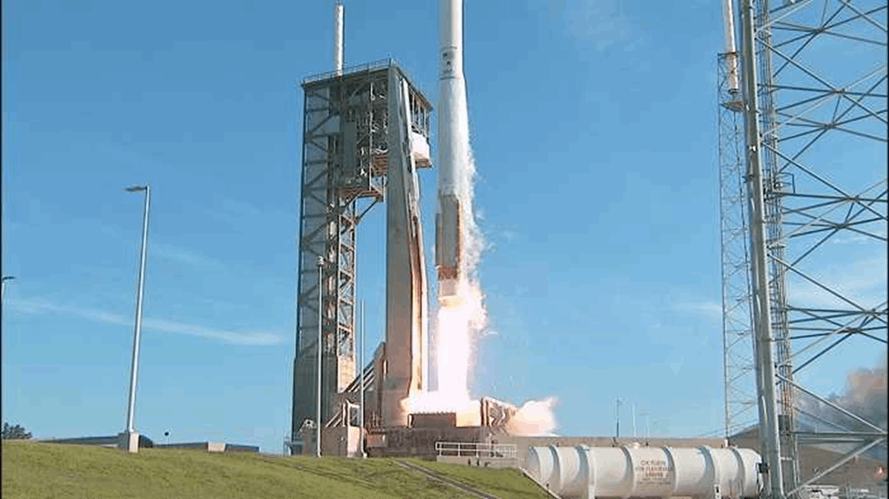
Tthe country’s first satellite, ZimSat-1 is being from the Mid-Atlantic Regional Spaceport on Wallops Island, Virginia, United States today.
The National Aeronautics and Space Administration confirmed the launch date about two weeks ago with the time set for 11:30 this morning.
The actual deployment of ZimSat-1 into space will be through the Japanese module.
“It is going to be deployed in the KIBO module; it happens two or three weeks after launch (today) and we have scheduled it for November 21,” Zimbabwe National Geospatial and Space Agency coordinator Dr Painos Gweme said.
ZimSat-1 will be on board the Cygnus NG-18, an uncrewed spacecraft that provides commercial cargo resupply services to the International Space Station. It will also carry two other small satellites from Japan and Uganda.
An official with the NASA ISS programme research office Ms Melissa Gaskill said in a statement that ZimSat-1 will help the country enhance its geospatial mapping capabilities and collection of crucial data for the development of agriculture.
The deployment of ZimSat-1, Gaskill said, will “help improve the livelihood of citizens of Zimbabwe”.
“The 18th Northrop Grumman commercial resupply services mission for NASA to the International Space Station carries out scientific investigations of topics such as plant mutations and mudflow structure along with a demonstration of camera technology and small satellites from Japan, Uganda and Zimbabwe,” she said.
Related Stories
ZimSat-1 is being sent into space under the BIRDS-5 project — a collaborative initiative involving ZINGSA, Japan’s Kyushu Institute of Technology and Uganda’s Ministry of Science and Technology.
“BIRDS-5 is a constellation of cubesats: Pearl AfricaSat-1, the first satellite developed by Uganda; ZimSat-1, Zimbabwe’s first satellite; and TAKA from Japan.
“BIRDS-5 performs multispectral observations of earth using a commercial off-the-shelf camera and demonstrates a high-energy electronic measuring instrument.
“The statistical data collected could help distinguish bare ground from forest and farmland and possibly indicate the quality of agricultural growth.
“This could help improve the livelihood of citizens of Uganda and Zimbabwe,” Gaskill said.
The satellite will immensely enhance the country’s mineral exploration, monitoring of environmental hazards and mapping of human settlements among other functions.


Leave Comments